
The Gežov saddle–Stratenec
Ridge route • red (E3) • demanding (a full day on the ridge with no facilities, over 700 m of climbing)On footOn cross-country skis
The The Gežov saddle–Stratenec section is 2.5 km long and takes about 50 min.
- The Gežov saddlestart • 1 040 m a.s.l.
red waymarks • 2.3 km
The red waymarks take you over meadows with views to the Moravian side to the summit clearing of Stratenec.
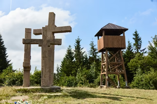 Stratenec2,5 km from the start • 1 055 m a.s.l.Three concrete crosses on the Javorníky ridge, one for each of the soldiers of the 1st Czechoslovak Army Corps who fell here on 3 May 1945 during the liberation of Velké Karlovice. Two of them got their names back only with a stone unveiled in 2022. A wooden lookout tower stands beside them.
variant • green waymarks via Bukovina
The descent from Stratenec to Velké KarloviceFrom the summit clearing the green waymarks lead over Bukovina down to Velké Karlovice; the other option is to go back to the Gežov saddle and drop to Podťaté. Both a bus and a train run from Karlovice.