
From Horní Bečva to Kotlová
Hiking route • green • moderate (a steady climb)On foot
From the Horní Bečva signpost (545 m) the green waymarks climb through the wood to the Pod Kotlovou saddle (820 m), where two surviving cottages of the lost settlement of Jezerné stand. From there the red ridge route leads on in both directions, or the yellow waymarks drop to the Karlovské lake.
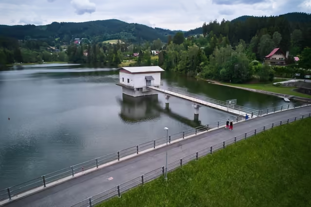 The Horní Bečva damstart • 545 m a.s.l.The only one completed of dozens of reservoirs planned between the wars. You can walk right round it, there is a large children's playground by the water, and a waymarked path leads from the dam to Kotlová and on to Karlovské jezero.
green waymarks • a steady climb
From the signpost by the dam follow the green waymarks towards Kotlová. The forest track climbs 285 metres to the Pod Kotlovou saddle, where the green waymarks join the red ridge route.
- Pod Kotlovou4,5 km from the start • 820 m a.s.l.
detour • red waymarks • +0,6 km one way • 870 m a.s.l.
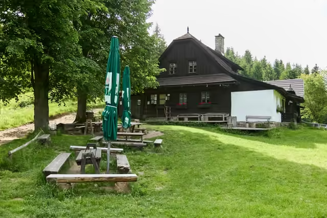 Kotlová (a short detour)Two last cottages of the lost mountain settlement of Jezerné stand in the saddle - in season refreshments are served from a serving hatch in one of them. From there the red waymarks climb through the wood to the wooded summit of Kotlová (870 m), which has no view; you return the same way.