Why come here
Water and holidays in the mountains
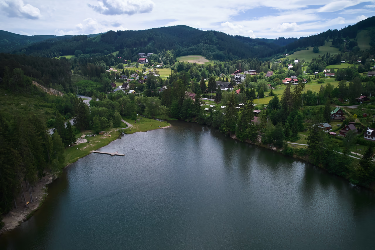
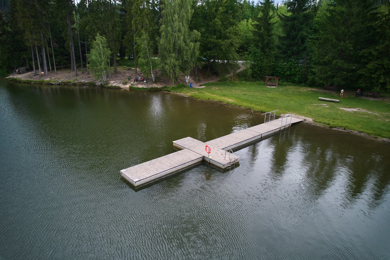
Natural swimming with a grassy beach and a gently shelving sandy entry. Plus a jetty, a children's playground and a walk along the crest of the dam with a view over the whole water surface.
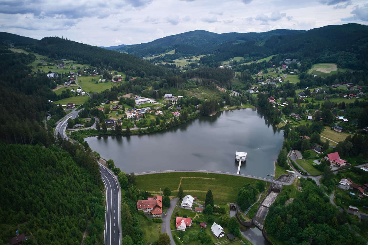
Reservoir • Horní Bečva • the Beskids
The only one completed of the dozens of dams planned for Wallachia between the wars.
2.5 km beyond the centre of Horní Bečva, the valley of the Rožnovská Bečva is closed by the curve of an earth dam. It was built here as a defence against flooding and it still protects against it today.
For visitors it offers water in the mountains: swimming from a grassy beach with a jetty, and a walk along the crest of the dam.
Why come here
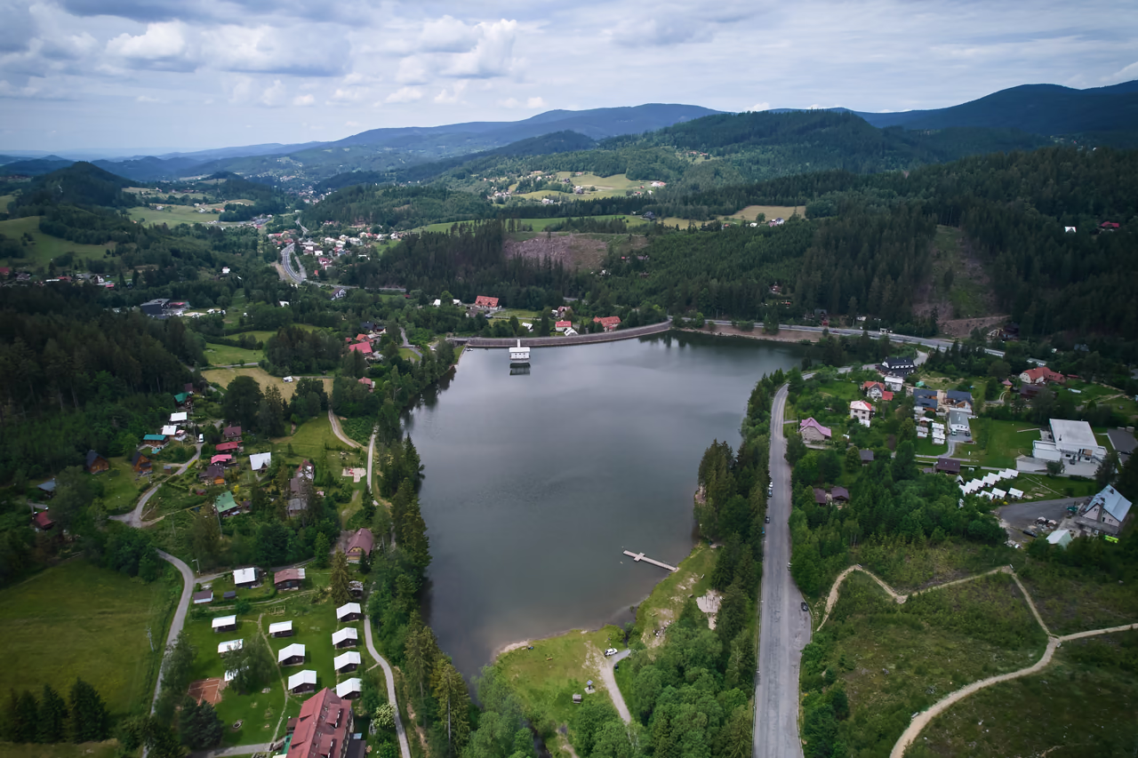
Natural swimming with a grassy beach and a gently shelving sandy entry. Plus a jetty, a children's playground and a walk along the crest of the dam with a view over the whole water surface.
When to come
Swimming is a summer affair – the regional public health authority monitors the water quality in season. Out of season it is mostly anglers and walkers who come. The reservoir is freely accessible all year.
What not to miss
Walk along the crest of the dam to the footbridge of the tower structure – the white house above the water. At the far end of the reservoir, try the circuit with the lookouts in the former quarry.

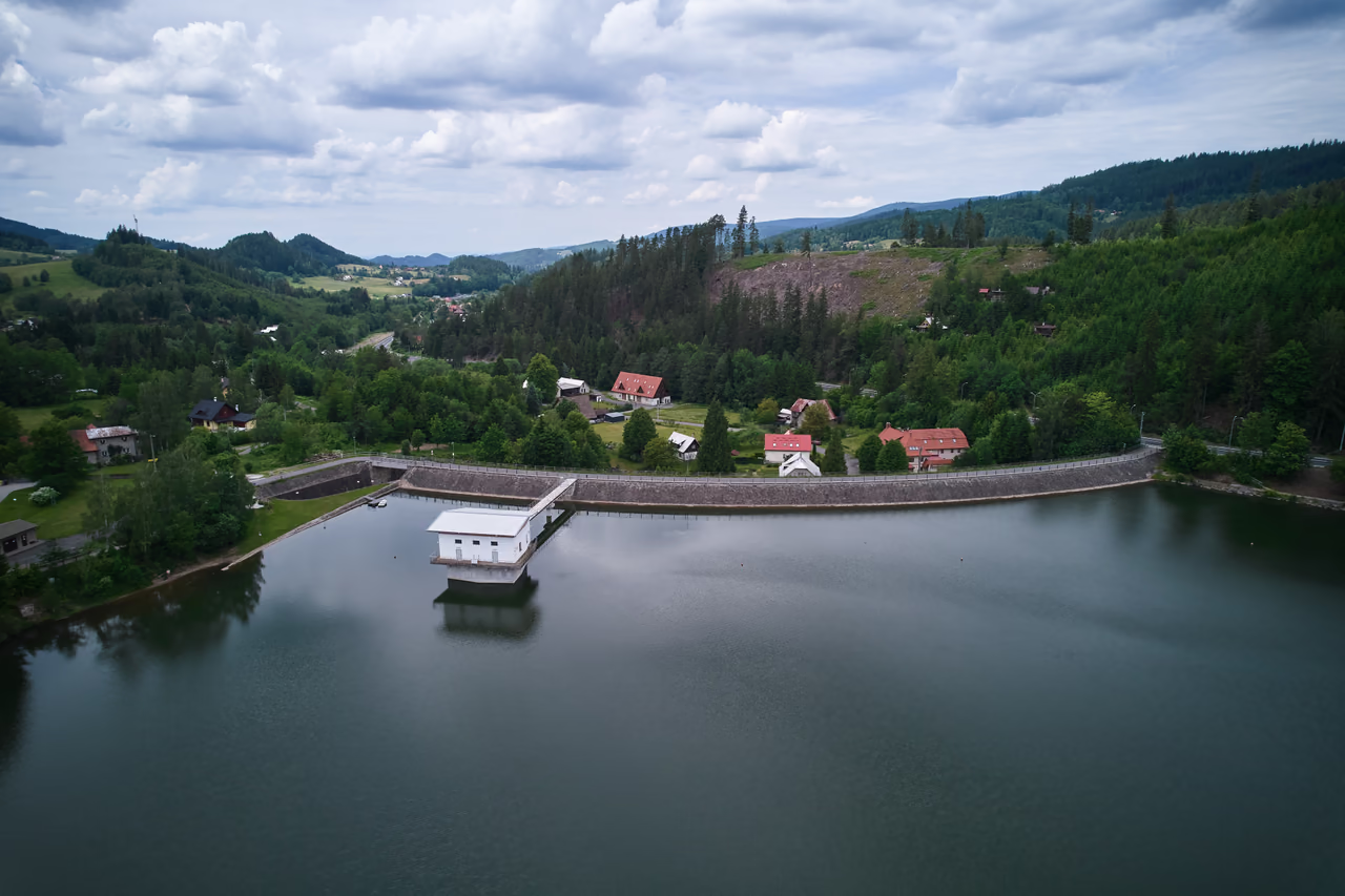
Of the dozens of reservoirs planned for Wallachia between the wars, one was built. It stands above Horní Bečva.
Floods and grand plans
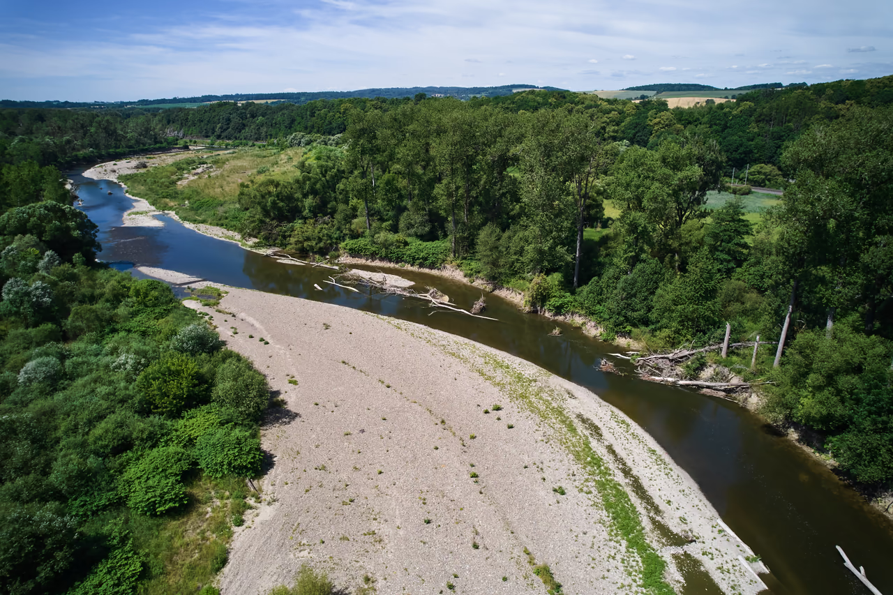
A hundred years ago
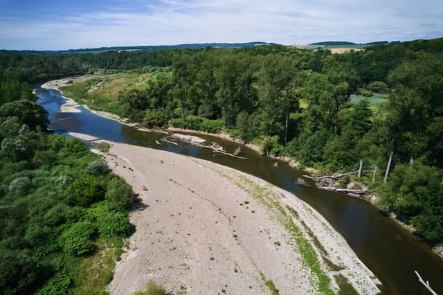
It ran in a wide, shallow gravel channel and cut itself a different course whenever it flooded.
At the beginning of the 20th century devastating floods swept through the Bečva valley. The answer was to be an ambitious one: a system of reservoirs in the mountains to catch the flood water before it could do damage.
The plans went further still. Most of the reservoirs under consideration were also to supply water to the proposed Danube–Oder Canal – a great dream of interwar Czechoslovakia.
In the end the grand plans came to nothing. By the middle of the 20th century only two dams had been built in the Bečva basin: Bystřička, finished as early as 1912, and Horní Bečva.
1933–1944
The design was drawn up by Stavební správa zemědělskotechnická v Prostřední Bečvě and approved by the ministry of agriculture on 16 March 1932. The state, the land of Moravia-Silesia and the municipality all shared the cost.
The designers chose the site of the dam with care: in the geologically difficult Carpathian flysch they found a stretch with sound bedrock. Several farmsteads were bought up and demolished for the future reservoir. The road that ran along the valley floor was moved to the slope above the future water level.
The dam is an earth dam. It was built up from local materials: the earth was dug in the area of the future reservoir itself and the stone came from quarries nearby, with better stone brought from the valley below Kněhyně. The work dragged on through the whole occupation: the dam was brought into service in 1944 and into permanent operation in 1947.
How it works
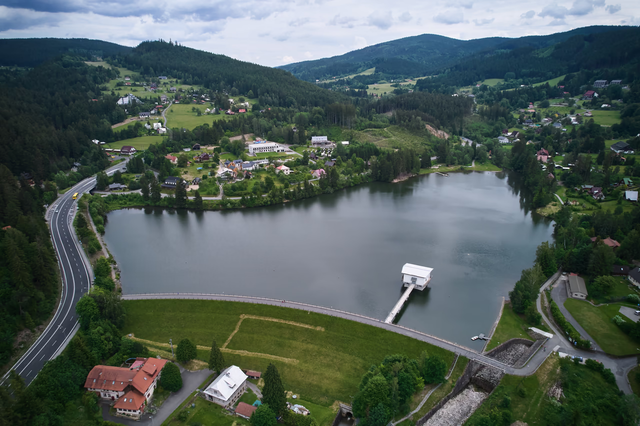
The earth dam curves in plan. A clay core makes it watertight, and stone pitching and paving reinforce the upstream face. Its main task has not changed in ninety years: to catch the flood surge and to top up the flow in the Bečva in dry spells.
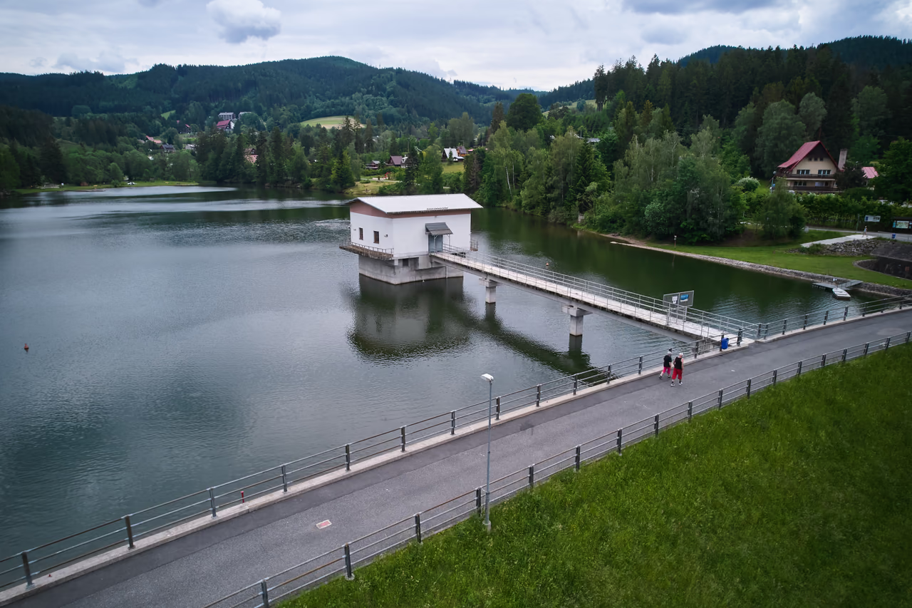
The white house above the water is the tower structure: inside are the bottom outlets, the machine rooms and a small hydroelectric plant. Water from the outlets runs away through a culvert beneath the body of the dam. High water is carried off by the spillway on the right bank.
The era of company holidays
Under socialism Horní Bečva became the holiday base of industrial northern Moravia. Tonak, Vítkovice and Autopal had chalets here – and so did dozens of other enterprises that brought their staff out.
More than fifty large holiday centres from that time still stand in the village, many of them almost unchanged. They go by different names now, but the retro look and fittings pull people in: guests come back out of nostalgia and show the chalets to their grandchildren.
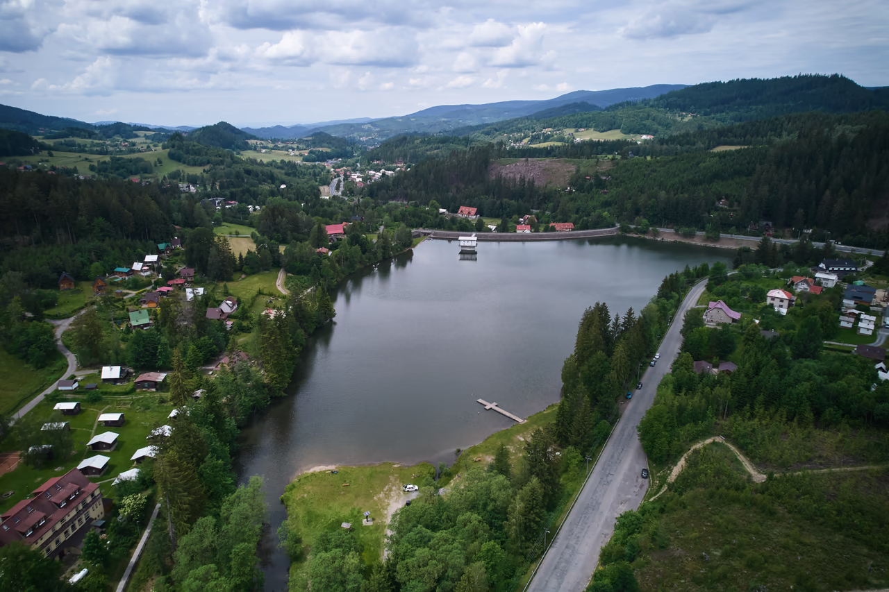
The chalet campsite at the upper end of the reservoir keeps something of that atmosphere too – and the shortest way to the beach leads from there.
Today
The dam still works above all as flood defence. For visitors, though, it is first of all a natural swimming place: a grassy beach with a gently shelving sandy entry, a jetty, a large children's playground, an outdoor gym and a public barbecue area.
Anglers find something here as well. The reservoir belongs to the trout beat Bečva Rožnovská 2 – besides trout there is carp and tench in it, though only permit holders may fish.
Timeline
early 20th c.
Devastating floods give rise to plans: to confine the channels of the braided rivers and build a system of reservoirs – most of them also to supply the proposed Danube–Oder Canal.
1912
The first dam in the Bečva basin is finished – Bystřička. It was built under Austria-Hungary, to plans older than those of the interwar republic.
1932
On 16 March the ministry of agriculture approves the detailed design by Stavební správa zemědělskotechnická v Prostřední Bečvě.
1933
First the road is moved from the valley floor onto the slope above the future water level. Then the dam starts to go up from local earth and stone.
1944
The work is completed under the occupation; the dam goes into permanent operation in 1947. Of the dozens of dams planned for Wallachia between the wars, this is the only one built.
2nd half of the 20th c.
Enterprises from northern Moravia build holiday centres for their staff at Horní Bečva. More than fifty large centres from that time still stand.
2021
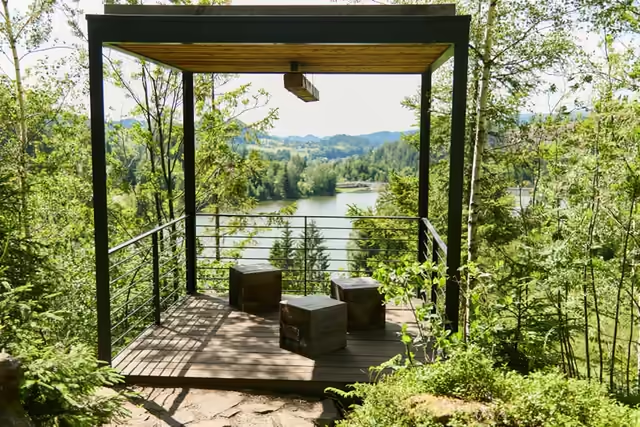
A circuit with three viewing cubes and a steel footbridge above the quarry face is created in the former quarry above the upper end of the reservoir.
Explore the lookoutsThe dam and the lookouts above the quarry belong together – only a few hundred metres of walking separate them. Put them into one short walk.
Right next door
When you have had enough of the water: a circuit with three viewing cubes and a footbridge above the quarry face has been created in the former quarry at the upper end of the reservoir. Waymarked paths carry on from here to Kotlová and to the Karlovské lake.
the paths opened
viewing cubes
circuit in the quarry
on foot · easy · fine with children
Walk along the crest of the dam to the footbridge of the tower structure. You will have the whole water surface laid out in front of you.
The shore path brings you to the bay with the jetty, the beach and the children's playground – the centre of things in summer.
The quarry is 150 m from the upper end of the reservoir. The circuit with three viewing cubes and a footbridge above the quarry face is manageable even for small children.
The ministry of agriculture approved the design on 16 March 1932, construction began in 1933, the dam entered service in 1944 and permanent operation in 1947.
Because of the floods at the beginning of the 20th century. It was one of dozens of reservoirs planned in the Beskids between the wars – and the only one of them that was finished.
Yes, it is an official bathing area – in season the water quality is checked roughly every 14 days by the KHS of the Zlín Region.
About 10 ha, with a maximum depth of around 7 m.
Yes, the reservoir is part of the trout fishing beat Bečva Rožnovská 2, and carp and tench are caught in it as well.
Under socialism more than fifty enterprises from northern Moravia built their own holiday centres here – many still stand almost unchanged and draw guests back out of nostalgia.
Otázka 1 z 4
 Rysík→
A few quizzes and I get glasses, and I will feel properly educated.
Your rank: Homebody. You do not have a single stamp yet. Visit any place and become a Pilgrim.
You can experience the Beskids and Moravian Wallachia with Rysík and without him. Rysík would love to be there for it. Whether you take him along and take on the challenges with him is up to you.
You can find your favourite places in your account. On the Walking routes page you can use them to filter routes.
Suggest a more accurate wording.
The dam is only one chapter in the story of the Rožnovská Bečva. Where the river rises and how people confined it is told by the neighbouring pages.
The braided river they confined
The river the dam was built for. What did it look like unconfined – the gravel channels and the regulation of the course through Rožnov?
Přejít na stránku →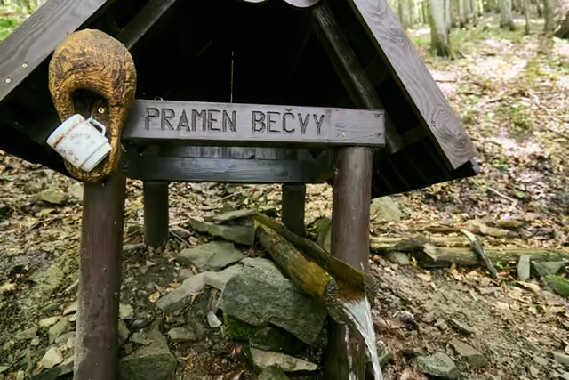
The start of the Bečva below Vysoká
The Rožnovská Bečva rises below Vysoká. The birth of the river, its name and its way to the Morava.
Přejít na stránku →Cubes and a footbridge above the quarry
A short way from the dam: a circuit through the former quarry with three viewing cubes and a footbridge above the quarry face.
Přejít na stránku →