
Veľký Javorník–The Gežov saddle
Ridge route • red (E3) • demanding (a full day on the ridge with no facilities, over 700 m of climbing)On footOn cross-country skis
The Veľký Javorník–The Gežov saddle section is 1 km long and takes about 20 min.
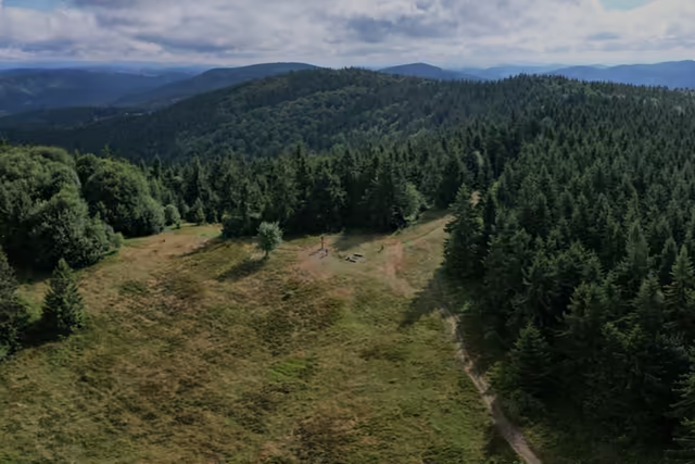 Veľký Javorníkstart • 1 072 m a.s.l.The highest summit of the whole Javorníky range. A wooden double cross, benches and a fire pit stand on the summit clearing. The summit lies wholly in Slovakia, where the cadastres of Makov, Štiavnik and Papradno meet.
red waymarks • 1.1 km
From the summit follow the red waymarks towards Stratenec down to the Gežov saddle, where the ridge meadow carries on.
- The Gežov saddle1 km from the start • 1 040 m a.s.l.