Why come here
The highest point of the range and a clearing with a double cross
The cross is banked with stones, with benches and a fire pit beside it. The red ridge route comes here from the Tripoint past Kasárne.
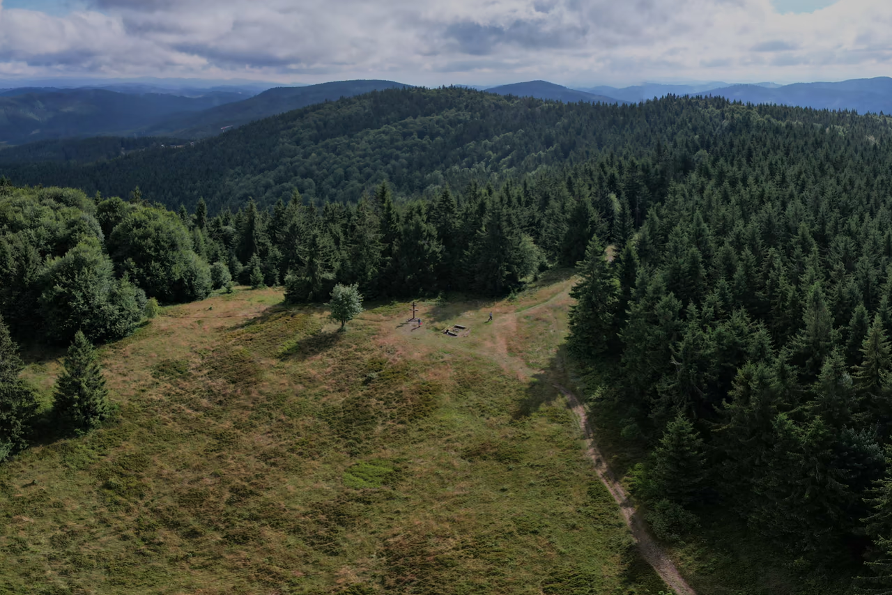
The range's highest summit • Makov • Vysoké Javorníky • 1,071.5 m a.s.l.
A wooden double cross banked with stones stands on the highest point of the Javorníky.
Veľký Javorník lies wholly in Slovakia, on the main ridge above Makov. There are benches and a fire pit by the double cross. On the slope below the summit lies the only national nature reserve of the Javorníky.

Why come here
The cross is banked with stones, with benches and a fire pit beside it. The red ridge route comes here from the Tripoint past Kasárne.
When to come
In winter the ridge carries a groomed cross-country ski track of the Beskydsko-javornícka magistrála. The same route is walked in summer.
What not to miss
Along the red ridge route, Stratenec has the Three Crosses memorial and a lookout tower of 2008. Both summits can be done in one walk.
The boundaries of three districts meet on the summit, and the oldest protected area in Kysuce lies on the slope below it.
Position on the ridge
In one short stretch the main ridge of the Javorníky carries three almost equally high summits: Stratenec (1,055 m), Veľký Javorník (1,071.5 m) and Hričovec (1,059 m). Between the highest and the lowest of them there is sixteen and a half metres.
The summit lies wholly in Slovakia, and so does the ridge that the red waymarks follow here.

On the summit
The boundaries of three districts meet on the summit – Čadca, Bytča and Považská Bystrica. The mountain itself extends into the cadastres of Makov, Štiavnik and Papradno.
The boundary of the Žilina and Trenčín Regions runs through here as well.
The watershed of the Váh and the Morava crosses the summit too. The northern slopes drain through Podťatý potok into the Vsetínská Bečva, the southern ones through the Štiavnik and the Papradnianka into the Váh. The two waters meet only in the Danube – the watershed of the Bečva and the Váh is told by the source of the Kysuca.
Since 1967
On the slope below the summit lies the Veľký Javorník national nature reserve. It is the only reserve of this category in the Javorníky. It was declared in 1967, as the first protected area in Kysuce.
It protects fir-beech woods with an admixture of spruce that have kept their old-growth character.
Level 5 protection applies here – the highest that Slovak nature conservation has. An area of 14 hectares comes to just under twenty football pitches. The surrounding wood belongs to the Kysuce Protected Landscape Area.
The summit lies on the main ridge of the Javorníky in Slovakia. The mountain extends into the cadastres of Makov, Štiavnik and Papradno. The nearest road ends at Kasárne, about 1.35 km from here as the crow flies.
On foot several waymarked routes lead here: the red along the ridge from Kasárne over Malý Javorník, the red from the Makov pass over the saddle of the same name below the summit, the green from the Podkýčera settlement and the yellow from Velké Karlovice. The ridge section is described by the red Javorníky ridge route.
Beskids passport
Are you here in person?
This page has already been added to your Beskids passport as a digital visit. To collect a badge for visiting in person, use the button below while you are there.
Your browser asks for your location once when you click. Verification happens offline on your device and your location is not sent anywhere.
A mountain settlement and resort on the ridge. The path from the settlement climbs through open meadows past the ski slope before it joins the main ridge.
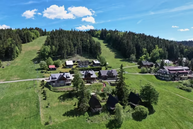
A clearing with a wooden double cross, benches and a fire pit.
The ridge route carries on west over the Gežov saddle to Stratenec – three crosses with a lookout tower a short way beyond the Czech-Slovak border.
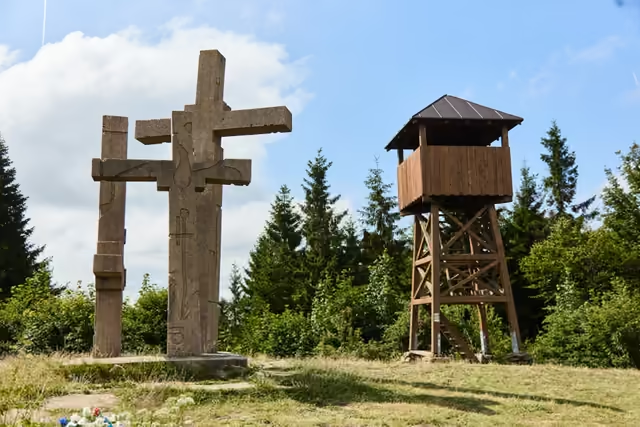
In winter the ridge carries a groomed cross-country ski track of the Beskydsko-javornícka magistrála – the same route that is walked in summer.
The summit lies in the Kysuce Protected Landscape Area, and on the slope below it is the Veľký Javorník national nature reserve. Keep to the waymarked paths.
The ridge is over a thousand metres above sea level – expect wind, mist and fast changes of weather.
There are benches and a fire pit on the clearing. Facilities are at Kasárne, 2.8 km along the waymarks from here.
The summit lies in Slovakia. The emergency number 112 works on both sides of the border.
The other Velký Javorník (918 m) stands in the Veřovické vrchy above Frenštát and has a lookout tower of its own. A route from Rožnov leads to it. Only the name connects it with this summit.
The summit lies wholly in Slovakia and the state border does not cross it. The boundaries of three Slovak districts meet on it, and the mountain itself extends into the cadastres of Makov, Štiavnik and Papradno.
1,071.5 m a.s.l. It is the highest summit of the Javorníky. Neighbouring Stratenec with its lookout tower is 1,055 m and Hričovec to the east 1,059 m.
A clearing, and in the middle of it a wooden double cross banked with stones. Benches and a fire pit stand beside it. The nearest lookout tower is on Stratenec, three and a half kilometres west along the red waymarks.
The Veľký Javorník national nature reserve has protected fourteen hectares of fir-beech woods with an admixture of spruce, of old-growth character, since 1967. It is the only national nature reserve in the Javorníky and the oldest protected area in Kysuce.
On foot along waymarked routes. The nearest way is from Kasárne on the red ridge route; others run from the Makov pass on the red, from the Podkýčera settlement on the green and from Velké Karlovice on the yellow. The nearest road ends at Kasárne.
Otázka 1 z 3
 Rysík→
A few quizzes and I get glasses, and I will feel properly educated.
Your rank: Homebody. You do not have a single stamp yet. Visit any place and become a Pilgrim.
You can experience the Beskids and Moravian Wallachia with Rysík and without him. Rysík would love to be there for it. Whether you take him along and take on the challenges with him is up to you.
You can find your favourite places in your account. On the Walking routes page you can use them to filter routes.
Suggest a more accurate wording.