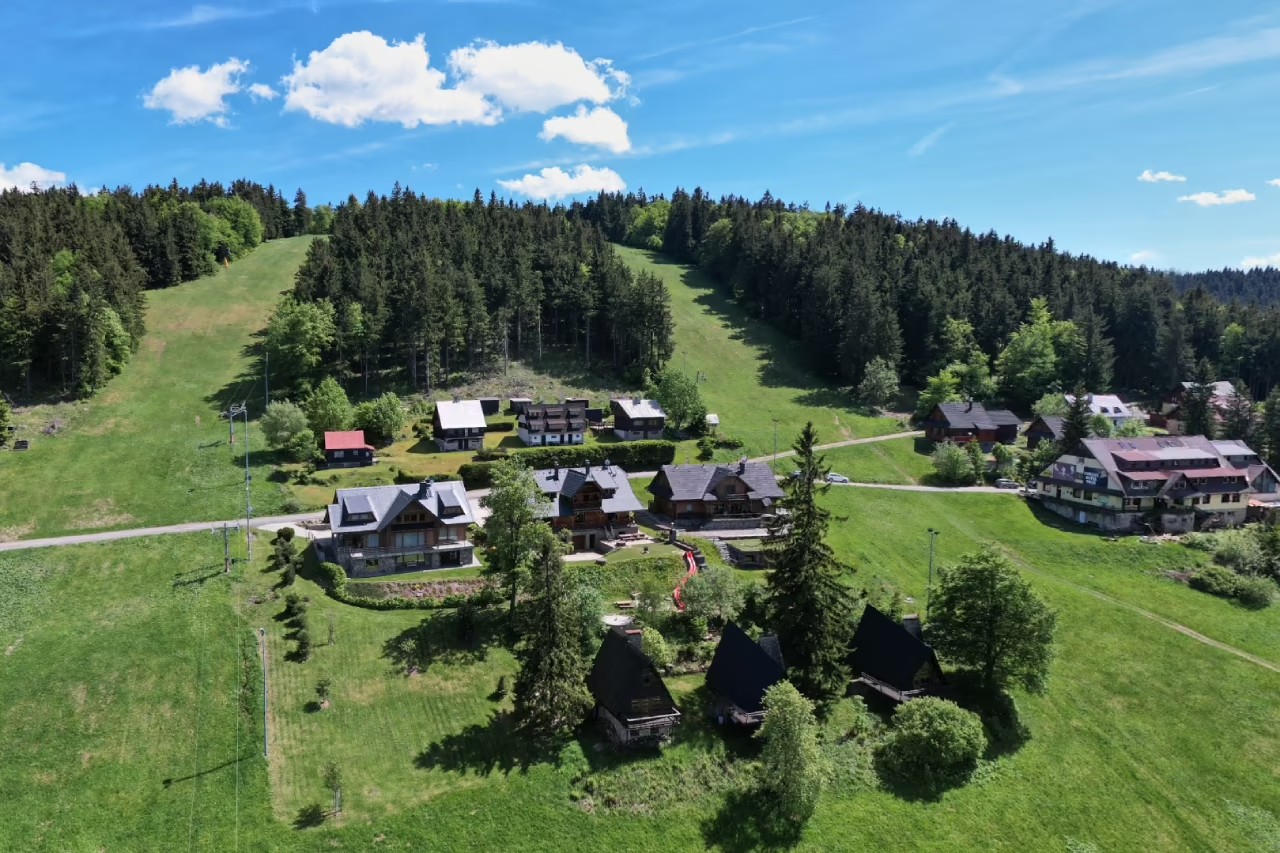
The meadows of the Kasárne settlement with a ski slope and cottages on the Javorníky ridge, from above

A mountain settlement and resort • Makov – Kopanice • ~1,000 m a.s.l.

Kasárne

A settlement on the Javorníky ridge that Moravia and Hungary pulled over for five hundred years. Today it is the gateway to Veľký Javorník.

The barracks are gone, the name stayed

High above Makov, in the Kopanice part of the village, lies a settlement named after soldiers – Kasárne, the best-known mountain place in Makov and the starting point for the Javorníky ridge. The border with Czechia is a few steps from the settlement, and about three kilometres of waymarked path lead from here to the highest summit of the range.

the year that fixed the border where it runs today
1734
the territory Czechia sought in vain to exchange
600 ha
the oldest reserve in Kysuce, below the summit
1967

Why come here

A ridge with views into two countries

The meadows above the settlement open views of the Moravian-Silesian Beskids and the Malá Fatra, and in good visibility as far as Hrubý Jeseník and the Strážovské vrchy. On the way across the meadows you can pick bilberries in summer. The border between the two countries also runs along the ridge – you walk right along it.

When to come

One resort, two seasons

In summer people set out from here on ridge walks and mountain bikes. The routes lead through meadows and beech woods of the Kysuce Protected Landscape Area. In winter a ski resort runs here with three slopes and evening skiing; along the ridge goes a cross-country magistrála between Kysuce and Wallachia.

What not to miss

The climb to Veľký Javorník

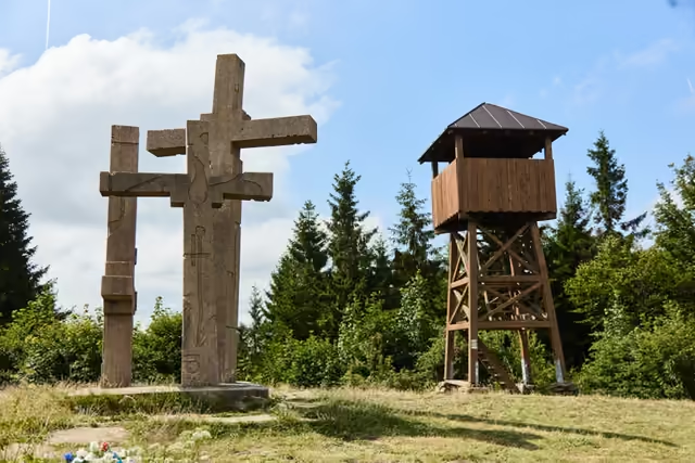
A waymarked path leads from the settlement to Veľký Javorník, the highest summit of the Javorníky (1,071.5 m). A short way further along the ridge you will find the wooden lookout tower on Stratenec and the Three Crosses memorial. Further west again lies the place called Portáš, named after a portáš patrol – see the portáš graves.

The story of the Kasárne settlement on the border

For five centuries lands and states pulled this piece of mountain back and forth. In the end it was named by the soldiers who guarded the border here.

1522–1734

The disputed land of Urgatina

The country between the Javorníky ridge and the Vsetínská Bečva, called Urgatina, originally belonged to Moravia. In 1522, however, the Hungarian king Louis granted the wish of the Podmanický family and – without seeking the consent of the Moravian land diet or even telling the Moravian lords – moved the land boundary as far as the Vsetínská Bečva.

Two centuries of commissions and raids followed: livestock and people seized, dwellings burned. The year 1733 alone left thirteen dead. Both sides agreed a compromise boundary on 31 August 1734; the emperor first approved it provisionally in 1735 and confirmed it definitively in 1738, once the maps of the surveyed boundary were finished. The territory of today's settlement stayed outside Moravia.

Where the name came from

Soldiers on the ridge

There used to be a guard post in the settlement for the protection of the border between Moravia and Hungary.

Then, when an epidemic of cholera broke out in Hungary, in 1833 barracks went up here for the soldiers who guarded the border and kept people from the Hungarian side from crossing it. The aim was to prevent the infection reaching Moravia.

The buildings are long gone; the name from the military guard on the border has stayed with the settlement to this day.

The 20th century to today

A settlement between two states

Skiing on these slopes began under the interwar republic. After the Second World War ski lifts multiplied, along with club and private chalets built mainly by enterprises from Zlín, Vsetín and Otrokovice; the access road came only from the Moravian side.

After Czechoslovakia divided, the chalets of Moravian owners were left across the border. The Czech government offered an exchange for other territory, the Slovak side accepted no variant and built a new road into the settlement from Makov. The dispute over the land under the chalets was taken up by the prime ministers of both countries in 2001; the border stayed where 1734 had drawn it – and thanks to Schengen you now cross it anywhere and without stopping.

Talks on the border
1993–2001, a boundary commission
The Czech side proposed
an exchange of 600 ha, or just the ~50 ha of the settlement
A new road from Slovakia
Makov – Kopanice – the Pindula saddle
The outcome
the border did not change

Timeline

A border in motion

  1. 1522

    The boundary on the Bečva

    The Hungarian king Louis grants the wish of the Podmanickýs and moves the land boundary to the Vsetínská Bečva – without the consent of the Moravian diet. Violent clashes begin.

  2. 1734

    A compromise boundary

    After the year 1733 with its thirteen dead, both sides agree on a compromise boundary on 31 August; the emperor first approves it provisionally in 1735 and confirms it definitively in 1738, once the maps of the surveyed boundary are finished. The territory of today's settlement stays outside Moravia.

  3. 1833

    Barracks against cholera

    In the settlement with its border guard post, barracks are built for the soldiers who, during the cholera epidemic in Hungary, keep the infection from reaching Moravia. They give the settlement its name.

  4. the interwar republic

    The first skiers

    Skiing on these slopes gains in popularity; after the Second World War ski lifts multiply here, along with club and private chalets built mainly by enterprises from Zlín, Vsetín and Otrokovice.

  5. 1939–1945

    A wartime survey

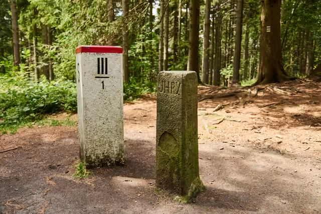
    The border of the Protectorate and the Slovak State is laid out so that the whole disputed territory belongs to Moravia. After the war the boundary of 1734 returns; some of the wartime border markers still stand.

  6. 1993–2001

    Talks between two republics

    After Czechoslovakia divides, a boundary commission discusses an exchange of territory; the border does not change. The dispute over the land under the Moravian chalets reaches the prime ministers in 2001.

  7. today

    A border without barriers

    The settlement is a popular centre for summer and winter walking and skiing; the border on the ridge is one you now cross without noticing.

Where next from Kasárne

Walks from the saddle

The walks on one map

The border ridge route to Veľký Javorník and the one to the Partisan memorial follow the same brown line, only in opposite directions; the green line heads through Greguše to Melocík.

To Veľký Javorník

red (E3)

  1. 1

    Across the meadows to the ridge~1 km

    The path from the settlement climbs through open meadows past the ski slope before it joins the border ridge.

  2. The summit of Veľký Javorníkdestination · ~3 km

    The highest point of the Javorníky. The lookout tower on neighbouring Stratenec and the Three Crosses are a short way further along the ridge.

  3. ↓

    Where next: Strateneclonger option

    The ridge carries on past the place called Portáš to Stratenec – three crosses with a lookout tower on the ridge a short way beyond the Czech-Slovak border.

    Stratenec
Route detail

To the Partisan memorial

red (E3)

  1. 1

    North along the bordera ridge route

    The waymarked path keeps to the border ridge and passes the turning down to the source of the Kysuca.

  2. The Partisan memorialdestination

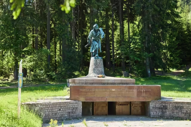
    The bronze statue of 1975 recalls the partisans' crossing of the border in 1944, by the Makov pass.

    The Partisan
  3. ↓

    Where next: Bumbálkalonger option

    The same ridge route carries on past the Tripoint to the Bumbálka saddle – a border crossing with a car park and the Bílá, Bumbálka, státní hranice bus stop.

    The Tripoint
Route detail

Through Greguše to Melocík

red

  1. The Greguše settlement~9.5 km

    Over the Čierna voda saddle you reach the log cottages, the wooden bell tower and Dolmen života a smrti.

    The Greguše settlement
  2. ↓

    Where next: Melocíklonger option · ~4 km

    The route carries on below Čerenka to the Melocík restaurant on the main road between Bytča and Makov – in winter the groomed cross-country ski trail runs along it too.

Route detail
Na závěr

Doplňující info a test znalostí

Rychlá rekapitulace

Why is the settlement called Kasárne?

After the military barracks that went up here in 1833 because of the cholera epidemic in Hungary – the soldiers were to prevent the infection reaching Moravia. The buildings are long gone; the name stayed.

Is Kasárne in Czechia or in Slovakia?

In Slovakia, in the Kopanice part of the village of Makov. The Czech-Slovak border runs only a few steps from the settlement.

How long has today's border on the Javorníky ridge been in place?

Since the compromise agreement of 31 August 1734, which the emperor first approved provisionally in 1735 and confirmed definitively in 1738. With a single wartime break (1939–1945) it has held ever since.

How far is it from Kasárne to Veľký Javorník?

About three kilometres of waymarked path lead from the settlement to the highest summit of the Javorníky (1,071.5 m a.s.l.).

Závěrečný kvíz

Otázka 1 z 4

What is the Kasárne settlement named after?

RysíkRysík→

There is a quiz a little further up. Shall we try it?

A few quizzes and I get glasses, and I will feel properly educated.

Try the quiz

Your rank: Homebody. You do not have a single stamp yet. Visit any place and become a Pilgrim.

You can experience the Beskids and Moravian Wallachia with Rysík and without him. Rysík would love to be there for it. Whether you take him along and take on the challenges with him is up to you.

Save Kasárne to your favourite places

You can find your favourite places in your account. On the Walking routes page you can use them to filter routes.

Something not right here?

Suggest a more accurate wording.