
Melocík – Greguše – Kasárne
Ridge route • red • moderateOn foot
A ridge route from the Melocík restaurant on the Makov road to the Kasárne settlement, where it joins the border ridge route. It crosses meadows with views of the Malá Fatra and the Moravian-Silesian Beskids and passes the turning to the log cottages and the bell tower in the Greguše settlement.
Part of a long-distance routeBeskydsko-javornícka magistrála
- Melocíkstart • 785 m a.s.l.
red waymarks • below Čerenka
From the Melocík restaurant on the road between Bytča and Makov the red waymarks climb to the ridge and run below the summit of Čerenka. The meadows open out to both sides: the Malá Fatra to the south, the Moravian-Silesian Beskids to the north. In winter a groomed cross-country ski trail runs this way.
- U Gregušov6 km from the start
red waymarks • along the ridge
From here the red waymarks drop along the ridge to the Čierna voda saddle.
detour • +0,6 km +11 min there and back • 895 m a.s.l.
 The Greguše settlementThe waymarks run above the settlement; from the junction the way to the log cottages and the bell tower at Gregušovci drops below the ridge and comes back the same way.
 - The Čierna voda saddle11 km from the start
red waymarks • joining the border ridge route
The last section climbs over ridge meadows to the Kasárne settlement - the only place on the route with a car park, a bus stop and somewhere refreshments can be bought.
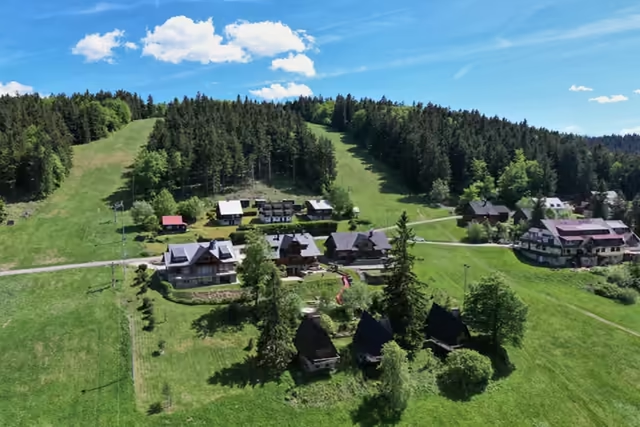 The Kasárne settlement14,5 km from the start • 950 m a.s.l.A settlement on the Javorníky ridge that Moravia and Hungary disputed for five centuries. It is named after the barracks of 1833, in which soldiers stopped people fleeing a cholera outbreak in Hungary; walks to Veľký Javorník (1,071.5 m) start here.
variant • red waymarks • along the border
Where to go on from KasárneFrom the settlement the border ridge route runs south to Stratenec with its three crosses and lookout tower, and north over the Tripoint to the Bumbálka saddle.