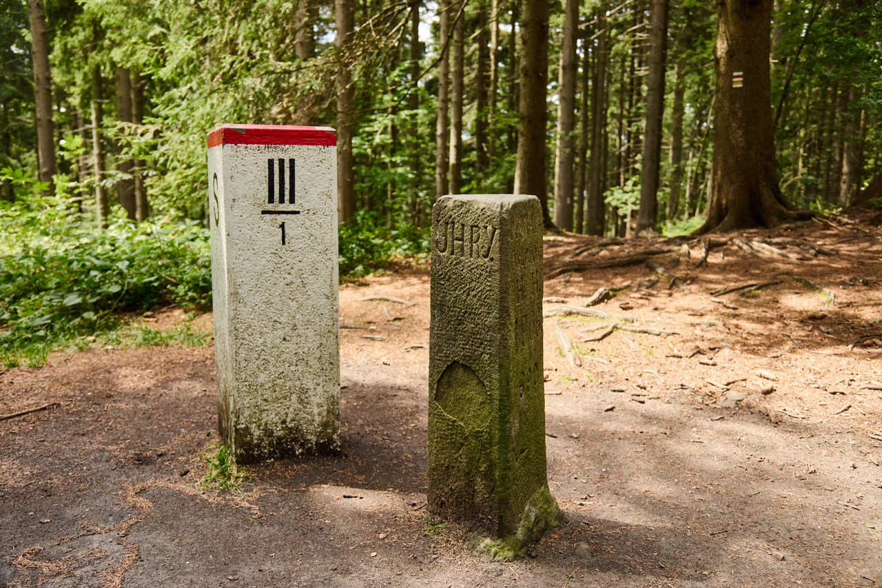
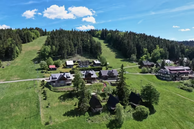
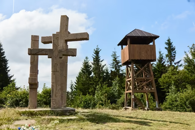
The clearing on the summit of Trojačka with two boundary markers – the white state border marker and the old stone of 1906

A historic boundary stone • the hill Trojačka • 939 m a.s.l.

The Tripoint

The border here has been rewritten twice since 1906 – the stone still stands. And today's border marker has gone up within arm's reach of it.

The past and present of a border within arm's reach

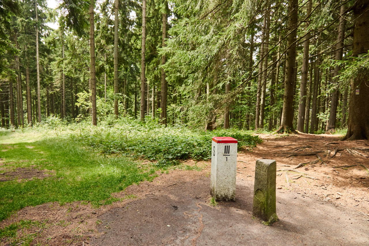
On a wooded summit a short way above Bumbálka stand two boundary markers close together. The sandstone boundary stone of 1906 carries the names Uhry, Morava and Karlovice – and a few dozen centimetres from it stands the white marker of today's Czech-Slovak state border.

The pair people come here for: the marker of today's state border and the boundary stone of 1906. Each marks a different age – and the same line.

Why come here

The making of a border in one place

There are few places where you see an old land boundary stone and a present-day border marker side by side. A few dozen centimetres – and more than a hundred years – separate the newer border from the older one.

What not to miss

Walking round the stone

Each of the three sides carries a different name: Uhry to the east (Makov), Morava to the north (Ostravice), Karlovice to the south (Velké Karlovice).

When to come

All year on the red route

From Bumbálka it is roughly a kilometre along the red ridge route. In summer you walk in the shade of the wood; in winter a groomed cross-country ski trail runs past.

Three sides of the stone

One stone, three names

The boundary stone has a triangular cross-section. Its three sides are a map: it stands where three cadastres meet, and each side points by name into “its” territory. The names, though, are from 1906 – walk round the stone and read who the neighbours were back then.

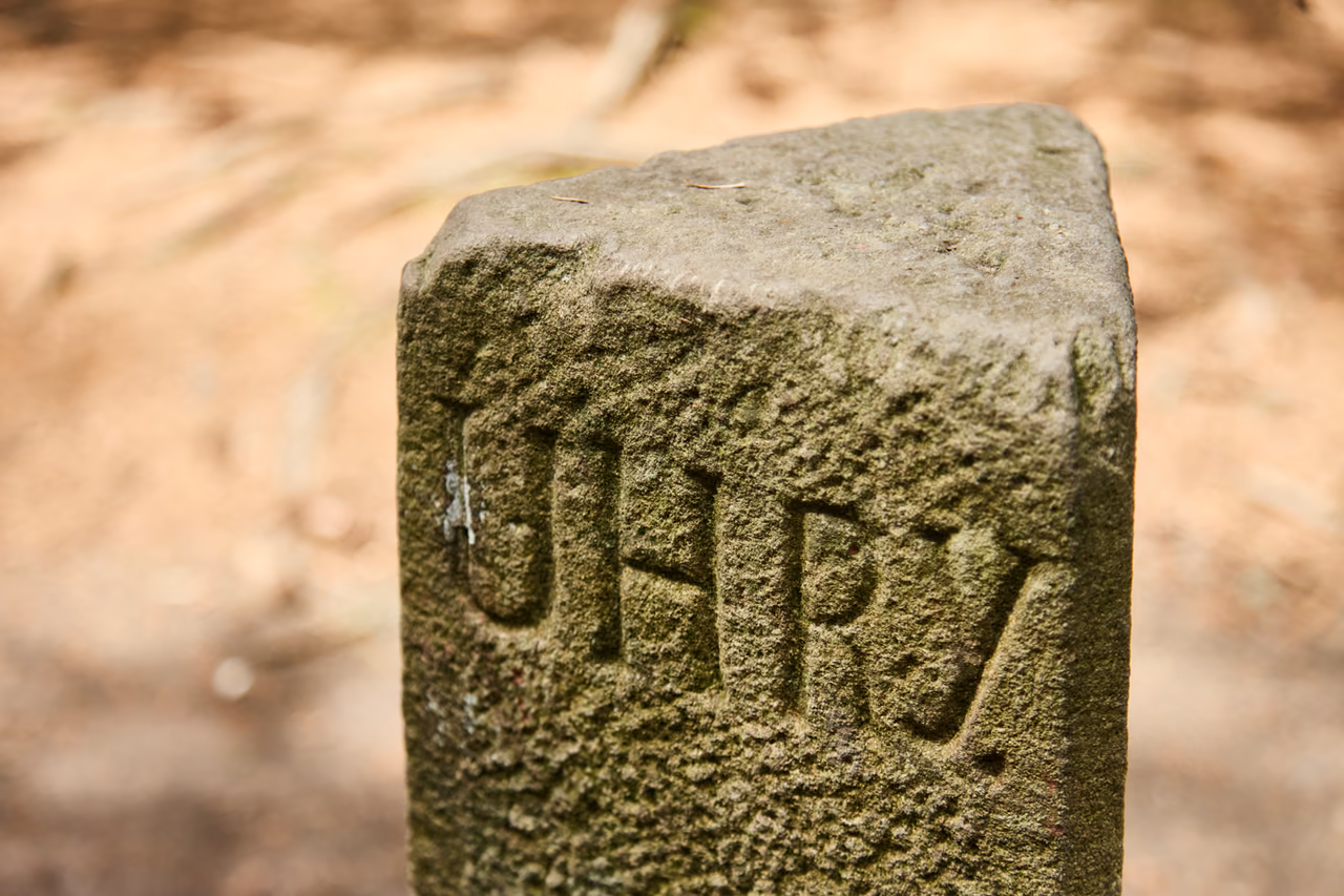
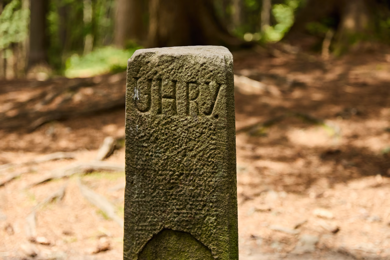
A close view of the side of the boundary stone with the carved word UHRY
The eastern side

UHRY

The side turned towards the cadastre of Makov. Kysuce belonged to the Kingdom of Hungary – so the boundary on the ridge was not only a village boundary but the boundary between the lands of the Hungarian crown and Moravia. Slovakia lies in that direction today.

What the name marked
The Kingdom of Hungary – the Slovak side today
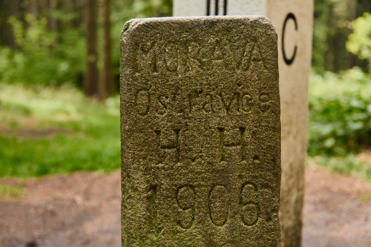
A close view of the side of the boundary stone with the inscriptions MORAVA, Ostravice, H. H. and the year 1906
The northern side

MORAVA · Ostravice

The front side, facing the cadastre of Ostravice as it then was. Below the name of the land is carved H. H. – Herrschaft Hochwald, the Hukvaldy estate of the archbishopric, which owned the woods here. The year 1906 and a registration number complete it.

What the name marked
Moravia – the Ostravice cadastre of the Hukvaldy estate
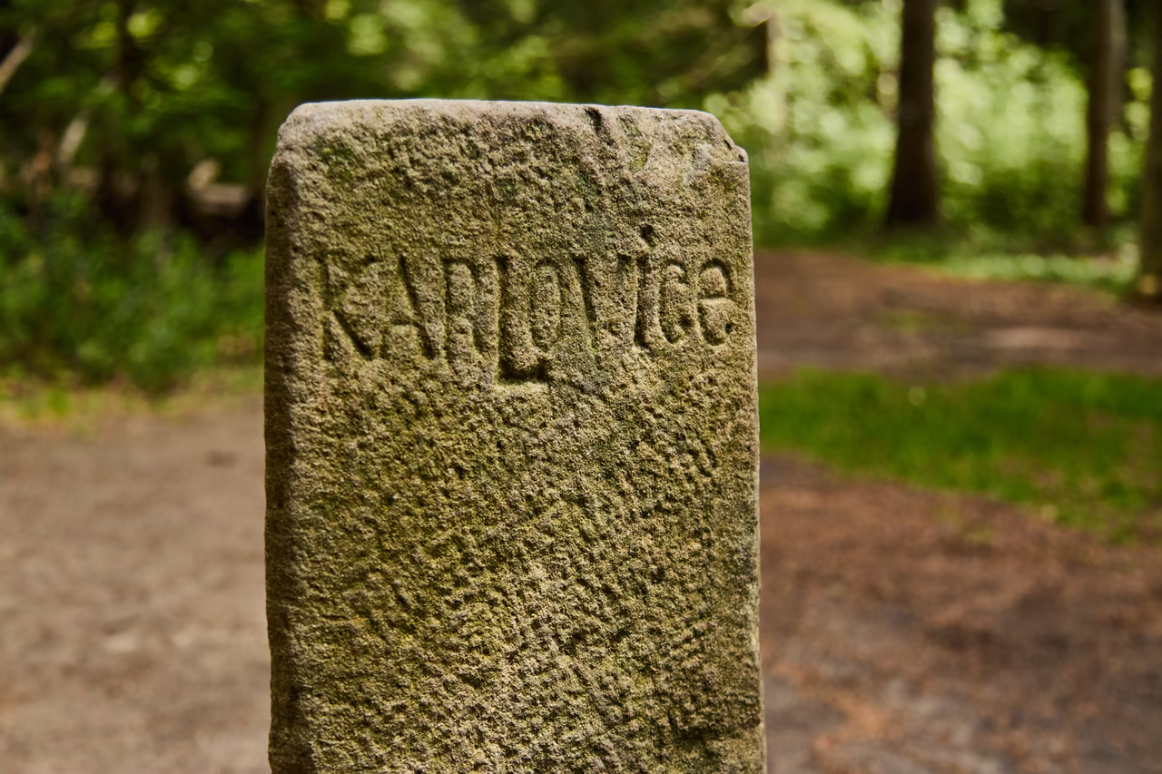
A close view of the side of the boundary stone with the carved word KARLOVICE
The southern side

KARLOVICE

The southern side points into the cadastre of Velké Karlovice. This Wallachian village in the upper Bečva basin reaches with its paseky as far as the ridge – and its cadastre touches those of Ostravice and Makov here to this day.

What the name marked
The cadastre of Velké Karlovice – Moravian Wallachia

The story of the border at the Tripoint

The border was here before the stone, and it has outlived every state that defined it. The stone of 1906 is its most legible witness.

A border older than the stone

A line along the ridge, drawn by water

The land boundary between Moravia and Hungary did not run here by chance. It followed the main ridge – and with it the main European watershed. Rain that falls on the northern side of the summit runs off by the Ostravice and the Odra to the Baltic; water from the other sides runs by the Kysuca and the Bečva to the Danube and the Black Sea. The boundary between the lands was drawn by the ground itself from the beginning.

What met on the ridge, though, were not states as we know them today, but estates and cadastres: the Ostravice woods of the Hukvaldy estate from the north, the paseky of Velké Karlovice from the south and Hungarian Makov from the east. It is exactly that meeting of three territories that the stone on the summit marks – which is why it has three sides.

Three turns up here in the language as well: by one reading the hill is called Trojačka because three mountain ranges meet here – the Vsetínské vrchy, the Moravian-Silesian Beskids and the Javorníky Mountains.

The old boundary stone on Trojačka seen obliquely from above – the triangular plan and the word UHRY are visible
The triangular plan shows best from above: three sides, three cadastres, three names.

The year 1906

A stonemason from Horní Bečva

At the beginning of the 20th century the Hukvaldy estate had its boundaries newly surveyed and set with stone markers. What came to Trojačka then was a triangular boundary stone of sandstone: only 25 × 24 × 26 centimetres in section, standing about 80 centimetres above the ground – and yet it has outlasted the states whose border it marked.

The lettering on the stone most likely has a particular author. The researcher Karel Jan Malina compared the shapes of the letters with a signature carved into the rock on Čertův mlýn – “Bolf Josef, kameník, H. B. 1903” – and concluded that the dressing and setting of the boundary stones here in 1903–1906 was probably the work of Josef Bolf of Horní Bečva (1868–1909), who trained in master Leide's quarry.

the stone set up
1906
triangular section
25 × 24 × 26 cm
height above the ground
80 cm

The border changes

The states were rewritten, the stone stands

The stone had stood in place for only twelve years when the first state vanished from its sides. In 1918 the monarchy broke up and Hungary ceased to exist. The border did not vanish with it: what had been a boundary between two lands of the monarchy became the Moravian-Slovak boundary within a shared state.

The border was rewritten a second time on 1 January 1993, when Czechoslovakia divided. Overnight an internal boundary became the border between two independent states – and so a white border marker stands beside the old stone: S on the Slovak side, C on the Czech. A few dozen centimetres and almost ninety years separate the two markers.

The three still holds today. At the summit Makov, Velké Karlovice and Bílá meet – and with them the Žilina, Zlín and Moravian-Silesian Regions. The tripoint has stayed; only its names have changed three times.

A white border marker with the designation III/1 and the old boundary stone side by side on the summit of Trojačka
The marker of today's state border carries C on the Czech side and S on the Slovak. The old stone stands within reach.

Timeline

One line, five ages

  1. for centuries

    A boundary along the ridge

    The land boundary between Moravia and Hungary follows the main ridge – and with it the main European watershed between the Baltic and the Black Sea.

  2. 1903–1906

    A new survey

    The Hukvaldy estate has the boundaries of its woods newly set with stone markers. Judging by the matching lettering, the dressing was probably the work of the stonemason Josef Bolf of Horní Bečva.

  3. 1906

    The stone on Trojačka

    The estate sets a triangular boundary stone on the summit with the names Uhry, Morava (Ostravice, H. H.) and Karlovice.

  4. 1918

    The end of Hungary

    Hungary ceases to exist and Czechoslovakia comes into being. From then on the same line is the Moravian-Slovak boundary within a shared state.

  5. 1993

    A state border once again

    With the division of Czechoslovakia the border between the Slovak and the Czech Republic runs along the ridge. A white border marker with S and C joins the old stone.

  6. today

    A tripoint of three regions

    At the summit the cadastres of Makov, Velké Karlovice and Bílá meet – and with them the Žilina, Zlín and Moravian-Silesian Regions. The red ridge route passes the stone.

Na závěr

Doplňující info a test znalostí

Rychlá rekapitulace

What is the Tripoint on Trojačka?

Two boundary markers on the summit of Trojačka (939 m a.s.l.): a sandstone boundary stone of 1906 with the names Uhry, Morava and Karlovice – and, a few dozen centimetres from it, the white marker of today's Czech-Slovak state border.

Why is the hill called Trojačka?

By one reading because three mountain ranges meet here – the Vsetínské vrchy, the Moravian-Silesian Beskids and the Javorníky Mountains. Today the summit is also a tripoint of three regions: Žilina, Zlín and Moravian-Silesian.
What do the inscriptions on the stone mean?

Each of the three sides pointed into a different cadastre: UHRY towards Makov, MORAVA with Ostravice and the year 1906 to the north (H. H. = Herrschaft Hochwald, the Hukvaldy estate), KARLOVICE to the south into Velké Karlovice.

How do I get to the Tripoint?

Most easily from the Bumbálka saddle on the Makov – Horní Bečva road along the red ridge route (E3) – roughly a kilometre of gentle climbing. A path also comes up from the Makov settlement of Trojačka, or along the longer ridge route from Kasárne.

Who carved the stone on Trojačka?

According to the researcher Karel Jan Malina, the dressing and setting of the boundary stones here in 1903–1906 was probably the work of the stonemason Josef Bolf of Horní Bečva – his signature is also carved by the spring on Čertův mlýn.

Závěrečný kvíz

Otázka 1 z 5

Which three names are carved on the sides of the stone?

RysíkRysík→

There is a quiz a little further up. Shall we try it?

A few quizzes and I get glasses, and I will feel properly educated.

Try the quiz

Your rank: Homebody. You do not have a single stamp yet. Visit any place and become a Pilgrim.

You can experience the Beskids and Moravian Wallachia with Rysík and without him. Rysík would love to be there for it. Whether you take him along and take on the challenges with him is up to you.

Save The Tripoint to your favourite places

You can find your favourite places in your account. On the Walking routes page you can use them to filter routes.

Something not right here?

Suggest a more accurate wording.