Why come here
You see the very beginning of a river
The outflow is led into a pipe: the water falls from it into a stone channel, and a few steps lower it is a brook. This water has 65.6 kilometres to go to the Váh.
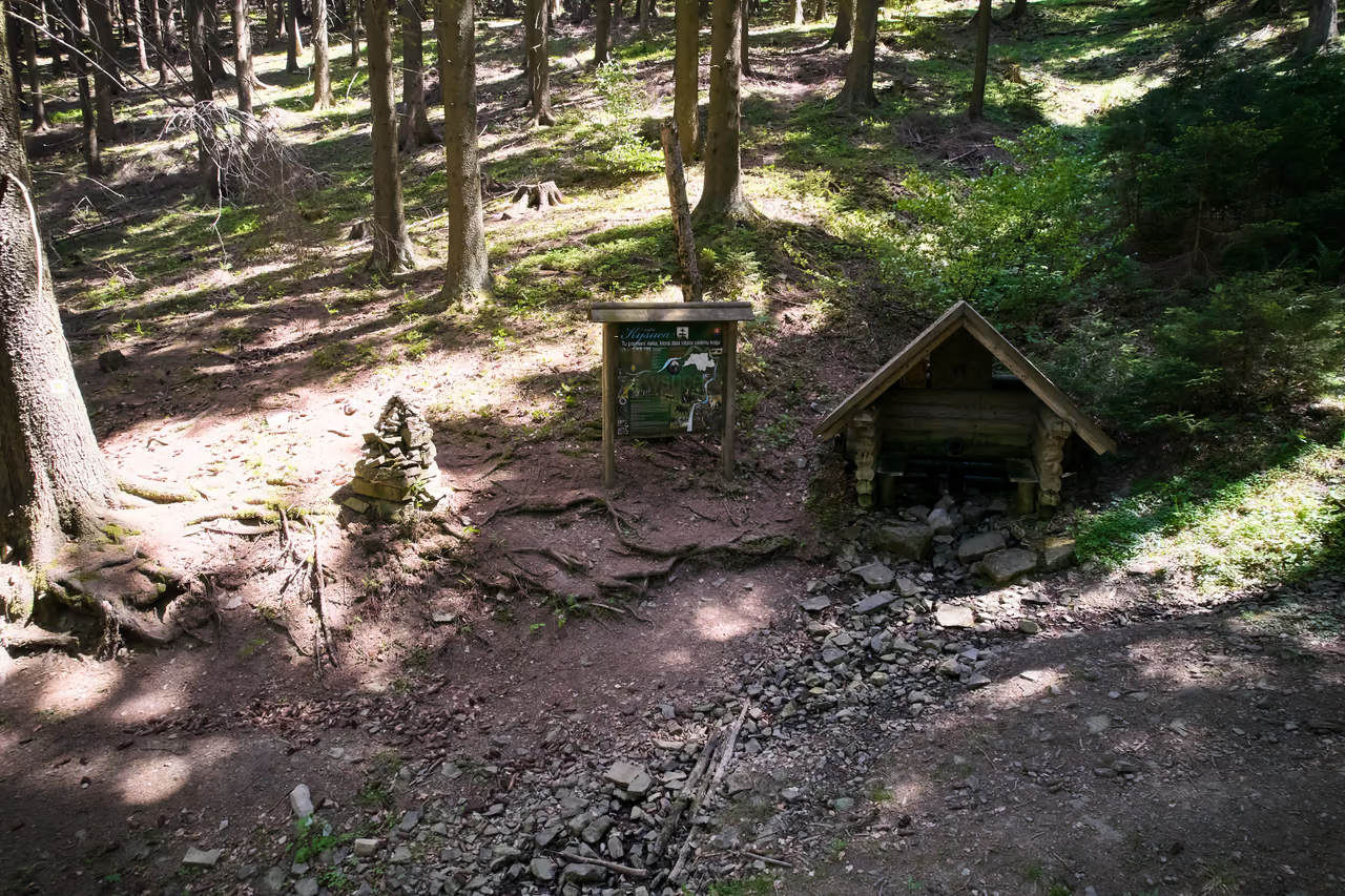
River source • the Javorníky • Makov • 915 m a.s.l.
It rises a few steps from the ridge above Makov that divides two river basins. The Kysuca heads for the Váh.
Above the U Jaši settlement at Makov, water comes out of the slope below the hill Hričovec – the water the whole region is named after.
Sixty-five kilometres on, at Žilina, it becomes a tributary of the Váh. On the way it passes through Turzovka, Čadca and Kysucké Nové Mesto and takes in twenty-seven rivers.
Why come here
The outflow is led into a pipe: the water falls from it into a stone channel, and a few steps lower it is a brook. This water has 65.6 kilometres to go to the Váh.
When to come
From Sedlo pod Lemešnou it is 1.5 km and about 180 metres of ascent, roughly 45 minutes' walk. The path goes through wood.
What not to miss
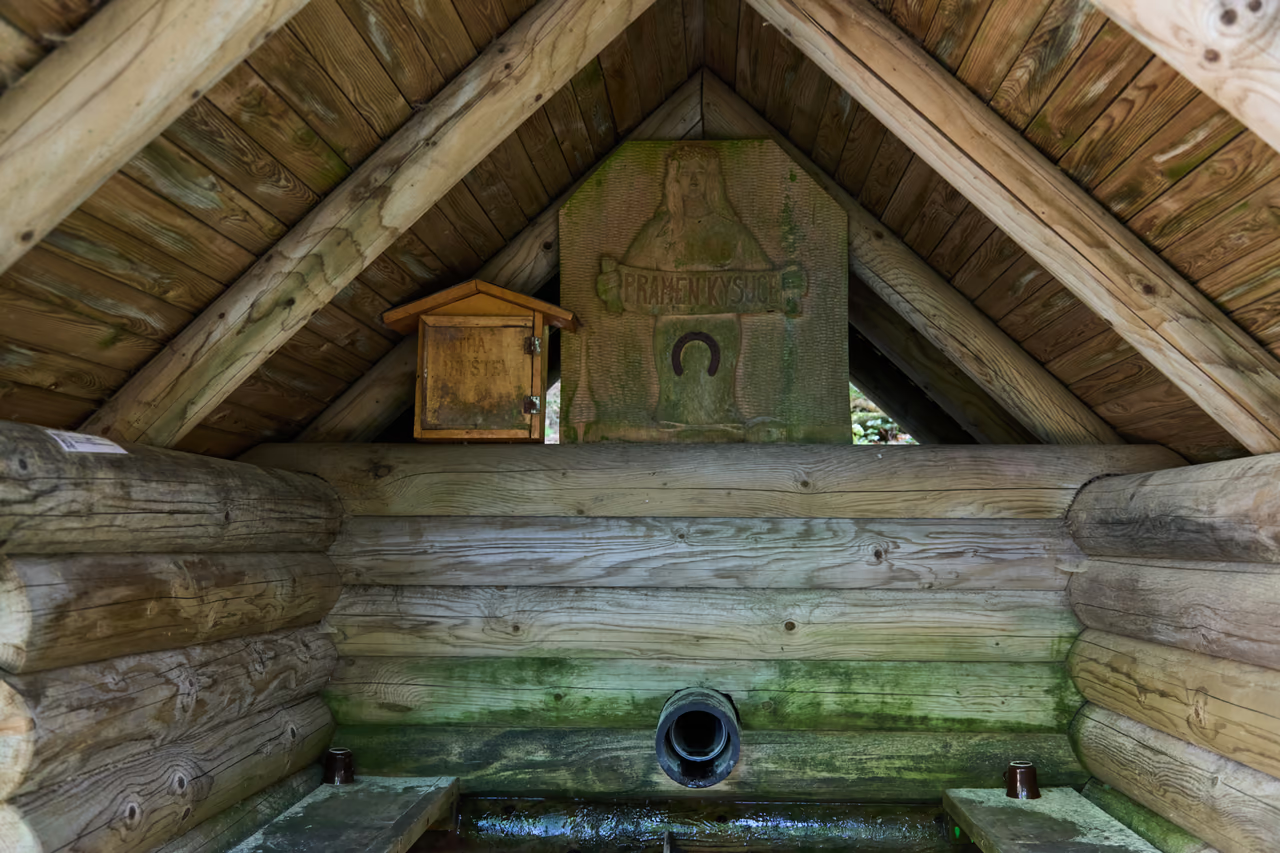
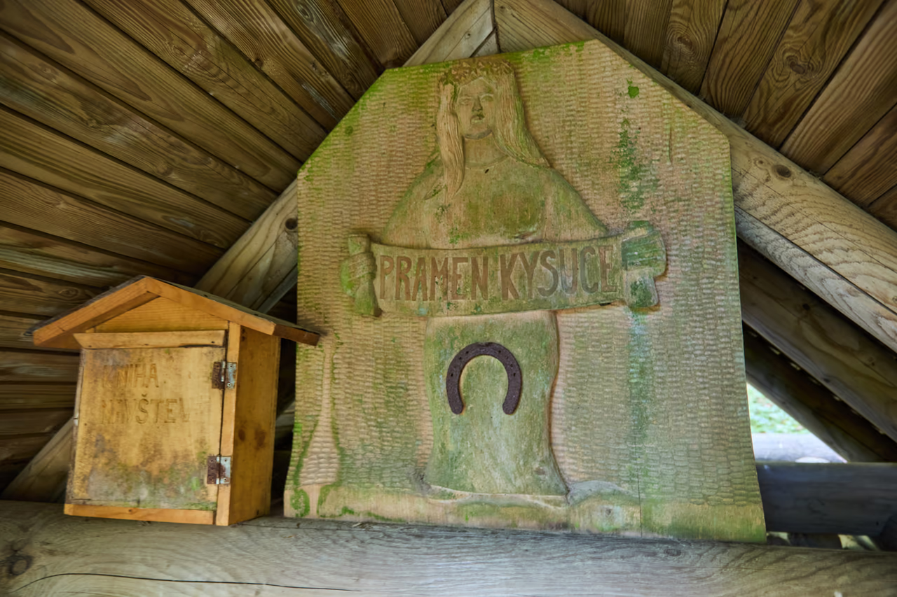
Under the roof hangs a carved board reading Pramen Kysuce, the source of the Kysuca, and beside it a wooden box with a visitors' book.

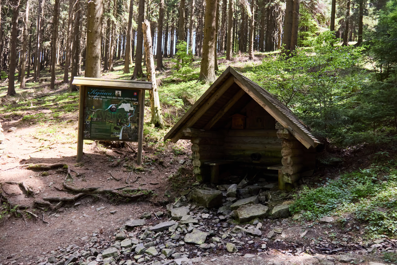
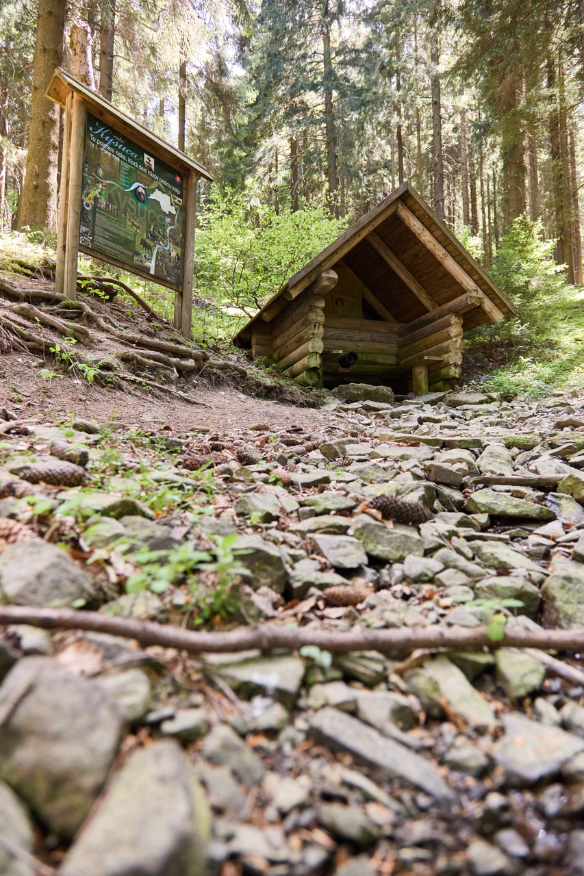
Three brooks come out of the slope above Makov. The main one gave the Kysuce region its name. Timber was floated down its water.
Which spring is the right one
In the Hričovec nature reserve above the U Jaši settlement, three brooks rise close together. Which of them is the true source of the Kysuca was long argued over.
The most abundant one won – it rises at 915 metres on the flank of the hill Hričovec (1,062 m a.s.l.).
The outflow is covered today by a log shelter with a pitched roof. The water of the spring falls from a pipe into a stone channel and runs away as a brook. Under the roof there is also a carved board reading Pramen Kysuce and a box with a visitors' book.
A nature trail of 2016 leads to the spring, with four panels and benches by the carver Jozef Šimek. A walk comes up here every year for the feast of Saints Peter and Paul.
The watershed and the way to the Váh
The same ridge that carries the hill Hričovec runs on above Makov – and exactly where the state border runs today lies a watershed. Rain that falls on the south-eastern side gathers in the Javorníky and runs off into the Kysuca, and from there into the Váh. Water on the north-western side of the ridge – a few hundred metres away – runs down into the Bečva, which rises on the opposite slope of Vysoká, the highest mountain of the Vsetínské vrchy. From there it runs on into the Morava and the Danube.
Water from the two sides of the ridge meets again, but only in the Danube, hundreds of kilometres away. Before that the Kysuca makes its own way – through Turzovka, Čadca and Kysucké Nové Mesto to its confluence with the Váh at Žilina.
0 km
Makov • 915 m a.s.l. • the Hričovec nature reserve
The most abundant of the three brooks at Makov. The water rises below the hill Hričovec (1,062 m a.s.l.) and heads east from the start, into the Makov valley.
The first few kilometres
The village came into being in 1895
The village, formed in 1895 by joining parts of seven settlements, already lies on the stream flowing from the source of the Kysuca. From here the river turns north-east and follows the valley.
Between two ranges
The Javorníky on the right, the Kysuce Beskids on the left
The valley of the Kysuca separates two ranges: the Javorníky on the right hand, the Kysuce Beskids on the left. The river runs north-east between them as far as Čadca.
The turn
The valley carries the railway and an international road
At Čadca the Kysuca changes direction and heads south. From that point its valley is the main transport axis of the region – the railway and an international road run along it. In the rafting days the Strečno estate had a timber depot here.
The lower course
A landscape of weirs
On the lower course stood a system of low weirs belonging to the Budatín estate – at Kysucký Lieskovec, Nové Mesto, Povina and Radoľa. They raised the level artificially so that a raft could pass even over the shallows.
65.6 km
At Budatín • the end of the journey
Below Budatín the Kysuca merges with the Váh and ends as a river of its own. The Váh carries its water to the Danube. The water of the Bečva, running down the other side of the ridge above Makov, reaches the Danube too, by way of the Morava – from there both go on to the Black Sea.
The river as a road
The Kysuca is shallow and its bed is stony – there was not the water here for the large rafts tied together on the Váh. The Kysuce raftsmen therefore built half-rafts: logs tied firmly only at the front and only along the edges at the back. And above all they waited. The raft lay on the bank and waited for the spring thaw or a good downpour. When the river rose, the raftsmen launched the rafts quickly and let the current carry them – each was steered by two of them, the more experienced at the front with an oar, the less experienced at the back.
So that timber could be moved outside the floods as well, low weirs were built on the river – low wooden structures reinforced with stone and filled with earth, which raised the water level artificially. The Budatín estate had a whole system of them at Kysucký Lieskovec, Kysucké Nové Mesto, Povina and Radoľa. High water took them regularly, though, so they had to be repaired almost without a break.
Into the Váh – after 65.6 km, on the edge of Žilina at Budatín.
At 915 m a.s.l., below the hill Hričovec (1,062 m a.s.l.) above the U Jaši settlement at Makov.
The ridge above Makov is a watershed. Water from one side runs down into the Bečva and on into the Morava and the Danube, water from the other into the Kysuca and on into the Váh – the two rivers meet only in the Danube.
From Sedlo pod Lemešnou on the road from Velké Karlovice to Makov – 1.5 km, 180 metres of ascent, roughly 45 minutes along a nature trail.
Otázka 1 z 4
 Rysík→
A few quizzes and I get glasses, and I will feel properly educated.
Your rank: Homebody. You do not have a single stamp yet. Visit any place and become a Pilgrim.
You can experience the Beskids and Moravian Wallachia with Rysík and without him. Rysík would love to be there for it. Whether you take him along and take on the challenges with him is up to you.
You can find your favourite places in your account. On the Walking routes page you can use them to filter routes.
Suggest a more accurate wording.