Why come here
An unassuming hill with a few surprises
A hill most people pass by on their walk hides varied broadleaved woodland. Crags and boulders near the summit. A small pond with amphibians lower down. And meadows where the corncrake calls.
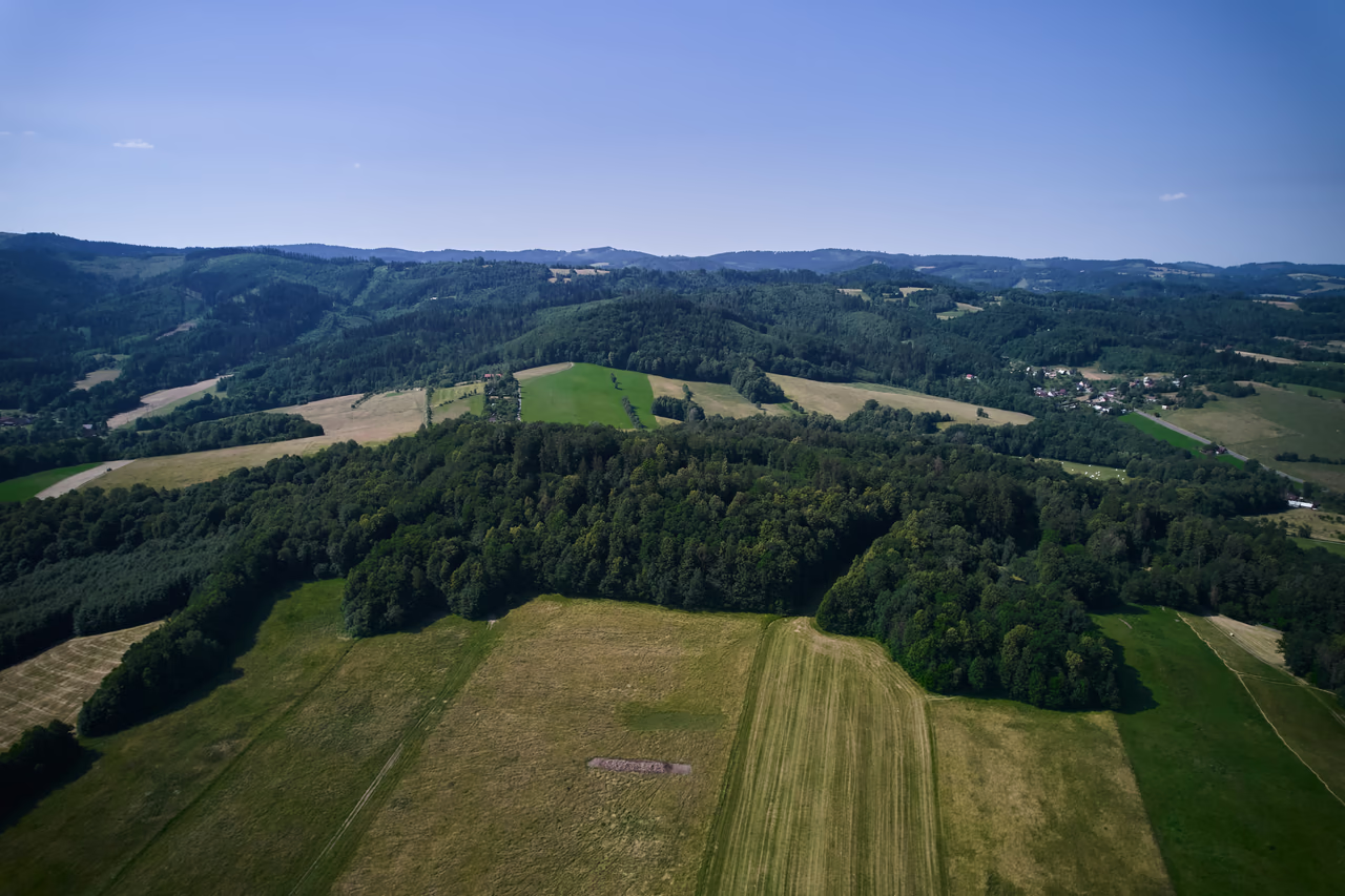
Hill and meadows • Rožnov pod Radhoštěm • 554 m a.s.l.
An unassuming hill with a corncrake you are more likely to hear than see.
The wooded ridge between Tylovice and Hážovice looks from a distance like any other hill. But its summit is formed by a nappe outlier – hard flysch thrust over a softer base that it is now sliding down. And in the meadows below the wood, the corncrake calls at night.
Why come here
A hill most people pass by on their walk hides varied broadleaved woodland. Crags and boulders near the summit. A small pond with amphibians lower down. And meadows where the corncrake calls.
When to come
The broadleaved woods are at their best in spring, when the ground flora is in flower. In summer, once the canopy closes, they look nothing like it. You will hear the corncrake on late spring and early summer nights, from the path.
What not to miss
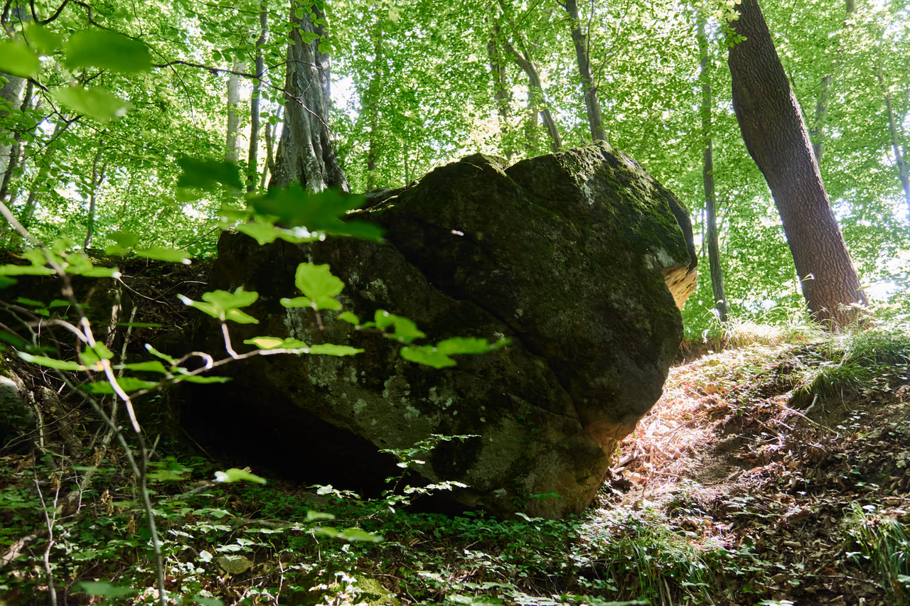
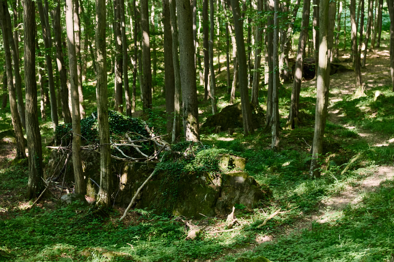
Sandstone slabs with a brown-grey weathering crust lie in the wood like scattered dice. This is the summit rock breaking apart – Rysová is a nappe outlier.
A summit from other mountains, and slopes sliding out from under it. And a name a village borrowed from the hill.
A piece of foreign mountains
Hills are usually made of the same rock from top to bottom. Rysová is not. Its summit is formed by the coarsely rhythmic flysch of the Křivé beds – sandstones, in places conglomeratic, belonging to the Rača unit of the Magura nappe. The slopes and foot below it are of quite different, softer material: the claystones and marls of the Silesian unit.
The explanation lies in the movement of the whole Carpathians. The Rača unit was thrust over the Silesian one – and when erosion then wore away the nappe around it, all that was left in the landscape was an isolated island. That is exactly what geologists call a nappe outlier: a piece of rock that stands above its surroundings because it is of harder material, which came here quite literally from elsewhere.
The Czech Geological Survey lists Rysová as an important geological site of great educational value.
A hard slab on a soft base starts to move
A hard body on a plastic base is an unstable combination. The firm sandstones of the summit press on the soft claystones beneath them – and those flow under the weight. The summit of Rysová therefore breaks apart at its edges and slides down the slopes: geologists speak of the gravitational collapse of a nappe outlier.
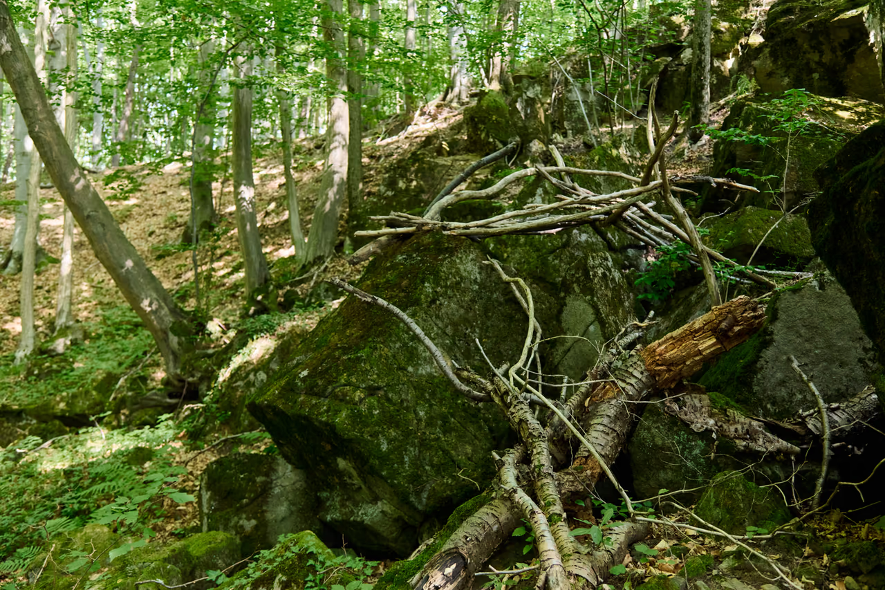
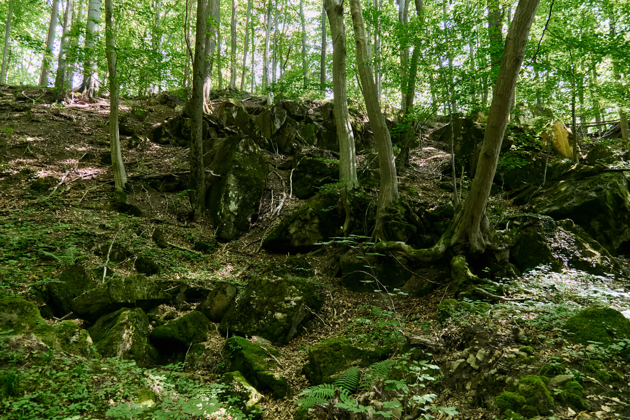
On the northern, south-western and north-eastern sides the summit is bounded by the main scarps of extensive landslides that cover the slopes. The sandstone blocks you trip over in the beech wood are pieces of the summit rock on their way down. It is precisely for this display of slope deformation that Rysová is in the database of geological sites – and the Czech Geological Survey gives “instability of the ground” as its main hazard.
What you will see on the ground
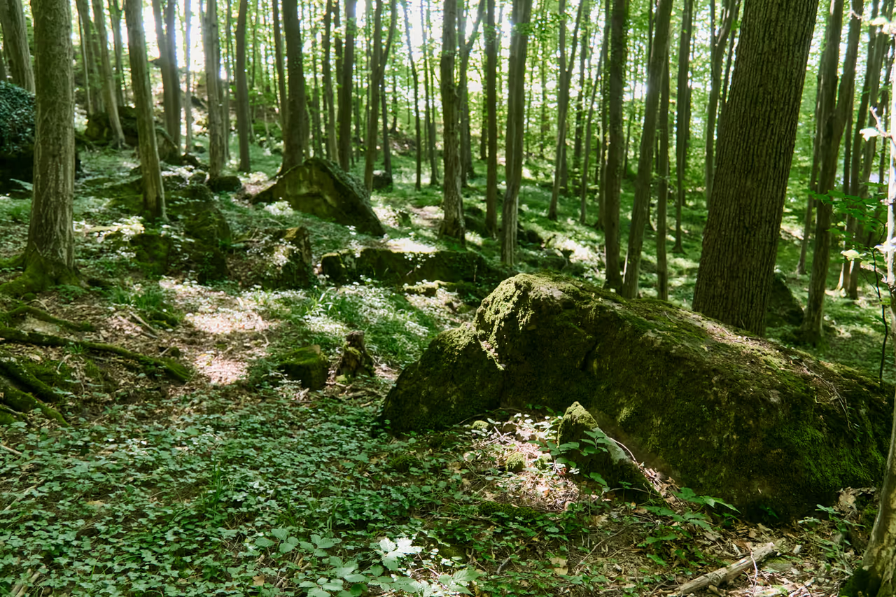
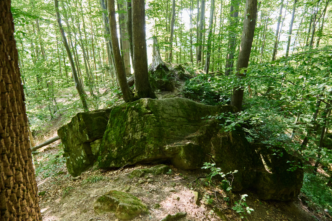
At the top is beech wood – and in it stones that by any ordinary logic do not belong there. Sandstone slabs and blocks lie tilted, cracked and moss-covered, some of them taller than a person. Shade and damp hold under the overhangs, and gaps and grooves open between the blocks.
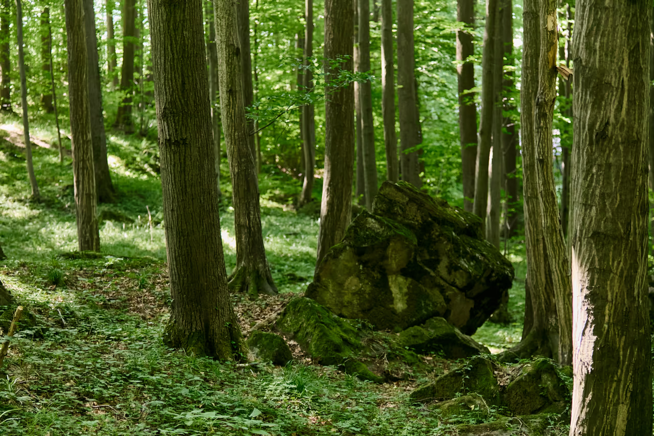
The wood itself is worth attention too. The varied broadleaved woods flower in spring – before the canopy closes, the flowering ground flora lights up the floor of the beech wood.
The mark of the sandstone here is its brown-grey porous weathering crust – the surface of the blocks looks quite unlike a fresh break in the stone. Around them, crumbling claystones lie in the scree and fall apart in the hand; that difference in hardness is the whole story of Rysová in a single handful.
The ground is broken and unstable – landslide scarps, hollows, slippery roots. No waymarked path leads to the summit. Anyone going there goes on their own account and with care; the red waymarked route from Rožnov pod Radhoštěm to Hážovické díly skirts the hill along its flank and is quite enough for most visitors.
The name
Hážovice and Tylovice had always been two separate villages on either side of one hill. In June 1960 they were merged into one, and the new village was named after the hill between them – Rysová.
It lasted twenty years. In 1980 Rysová was joined to Rožnov pod Radhoštěm and split again into two districts under their original names. The name Rysová stayed with the one it had belonged to from the start – the hill.
The stone from the area carried it too: in Tylovice there is a disused Rysová quarry, today a geological site with well exposed beds of sandstone. Small old quarries can be found on the slopes of Rysová itself as well.

A voice you hear long before you see anything
In the meadows that wrap around the hill nests the corncrake – a strongly endangered bird in Czechia, whose survival depends on one thing alone: when the meadow is mown.
The corncrake is smaller than a pigeon, rust-brown, a phantom of a bird. It lives out of sight and only its voice gives it away. The males call at dusk and in the night with a dry, rasping crex crex that carries across the meadow and repeats to exhaustion. In tall grass it treads out runs, almost tunnels, through which it moves in a flash, so that a call from two places may still be one bird.
The birds return from their wintering grounds in south-eastern Africa at the turn of April and May and nest on the ground in tall grass. That is precisely the trouble: the corncrake needs meadows mown only in summer. It cannot get away from a mowing machine in time.
A bird that was once common is now protected across Europe for its rarity. That does not make it everyone's favourite: because of it farmers cannot dry their hay in time, and on Rysová its presence long blocked house building. From the lowlands the corncrake has all but disappeared since the mid-20th century, and its stronghold remains the middle and higher ground, which includes the meadows of the Rožnov area. Where farmers put the mowing back (and are compensated for it), the corncrakes stay.
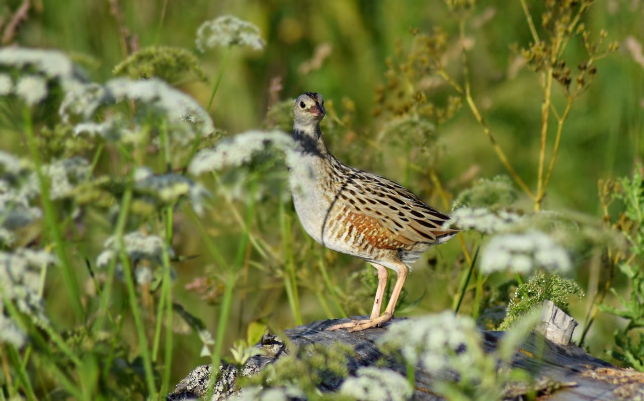
“crex… crex”
The meadows are private and farmed. The corncrake nests in grass you cannot tell from any other from the path – so do not walk into the sward, especially from May to the end of summer. You can listen from the path; nobody sees more of a corncrake than its voice anyway.
Timeline
Late Cretaceous
Flysch sediments are laid down in the Carpathian sea – sand and clay in turn. From them come the rocks of both units that meet on Rysová.
Palaeogene
The coarse calcareous and arkosic sandstones of the Křivé beds of the Zlín Formation are deposited – the future hard summit of the hill.
The nappes are thrust
In the folding of the Carpathians the Magura nappe is thrust over the softer Silesian unit. The hard slab ends up where it does not belong.
Erosion
Erosion wears away the nappe around it. The isolated remnant above the landscape is a nappe outlier – the summit of Rysová (554 m a.s.l.).
To this day
A firm body on a plastic base collapses under gravity; extensive landslides with main scarps below the summit cover the slopes.
1960
Hážovice and Tylovice merge into one village. It takes its name from the hill between them.
1980
Rysová is joined to Rožnov pod Radhoštěm and split back into Hážovice and Tylovice. The name stays with the hill.
2012
Rysová is written up in the Czech Geological Survey's database of important geological sites as an example of a nappe outlier.
Beskids passport
Are you here in person?
This page has already been added to your Beskids passport as a digital visit. To collect a badge for visiting in person, use the button below while you are there.
Your browser asks for your location once when you click. Verification happens offline on your device and your location is not sent anywhere.
You will find the red waymarks at the Rožnovský nultý kilometr marker near the bridge on Nádražní street. They lead you out of town across Masaryk Square and through the Kramolišov district.
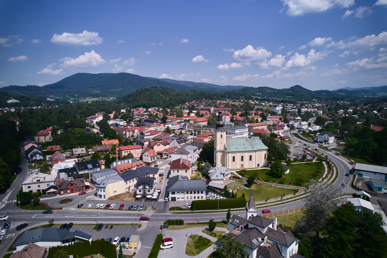
Beyond Kramolišov the waymarks dip into the valley of the Žáry brook and climb through a landscape of clearings and small woods above Rožnov.
The red route passes Rysová along the flank – the summit with its breaking rock stays aside, unwaymarked. From the path there is a view of the meadows below the hill; on late spring evenings you will hear the corncrake from here.
The junction where the red route crosses the blue. Hospoda Na Dílech and a small chapel stand here – and the longer ridge variants begin from it.
From Hážovické díly you can carry on along the ridge – by way of Vigantice, from where you can return by public transport (check the connection beforehand), or as far as Soláň – Čarták.
To the summit without waymarks: landslide ground – scarps, hollows, moss-covered blocks and slippery roots. Anyone setting out for the summit leaves the waymarked paths and goes at their own risk. Do not walk into the meadows around the hill.
Free, open at any hour. Rysová is ordinary countryside in the Beskydy Protected Landscape Area – no ticket office, no gate. The meadows around it are private and farmed.
Extensive landslides cover the slopes; the Czech Geological Survey names “instability of the ground” as the hazard. After rain the moss on the blocks is as slippery as ice.
From May to the end of summer the corncrake nests on the ground in tall grass in the meadows around. Listen from the path, do not walk into the sward and keep your dog on a lead.
Into the woods in spring, when the ground flora is in flower (and the blocks show best before the leaves are out) or in autumn. For the corncrake, after dark at the turn of spring and summer.
Refreshments and toilets are in Rožnov pod Radhoštěm.
A hill (554 m a.s.l.) about 1 km south of Tylovice – a nappe outlier that is collapsing under gravity. The meadows below it are home to the corncrake.
No, no waymarks lead to the summit and the ground is unstable because of the landslides. The nearest waymarked route (the red KČT one) only runs along the flank.
The exact origin of the name has not survived. What is certain is that between 1960 and 1980 the surrounding area carried it too: the merged Hážovice and Tylovice became the village of Rysová for that time, named after the hill between them.
It is a strongly endangered species in Czechia that nests on the ground in tall grass in the meadows around the hill – from the path you cannot tell the nest from the grass around it. That is why nobody walks into the sward from May to the end of summer.
No, the Rysová quarry lies in Tylovice and is a separate geological site – it only shows that the name was carried by the area around the hill as well.
Otázka 1 z 6
 Rysík→
A few quizzes and I get glasses, and I will feel properly educated.
Your rank: Homebody. You do not have a single stamp yet. Visit any place and become a Pilgrim.
You can experience the Beskids and Moravian Wallachia with Rysík and without him. Rysík would love to be there for it. Whether you take him along and take on the challenges with him is up to you.
You can find your favourite places in your account. On the Walking routes page you can use them to filter routes.
Suggest a more accurate wording.